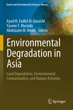
Environmental Degradation in Asia, 1st ed. 2022 Land Degradation, Environmental Contamination, and Human Activities Earth and Environmental Sciences Library Series
Coordonnateurs : Al-Quraishi Ayad M. Fadhil, Mustafa Yaseen T., Negm Abdelazim M.

This unique book focuses on environmental degradation in Asian countries including land degradation and soil erosion. The land degradation covers assessing environmental degradation using geospatial technology, land use land cover mapping, environmental and anthropogenic degradation, assessment of land degradation vulnerability, evaluation of the impact of earthquake and the environmental control of the sand dunes.
It also addresses the soil degradation and environmental pollution and presents several case studies such as tectonic activity and erosion, assessment of aircraft sound, soil degradation assessment for the arid territories, soil pollution, waste engine oil contamination, soil degradation, soil erosion modelling, land use and land cover change and its effect on soil erosion changes.
Additionally, the book discusses the impact of climate change, and human activities including urban environmental quality, air pollution and the impact of armed conflict on the environment. Moreover, topics such as vegetation degradation including forest changes, hydrological and agricultural drought are presented. The book includes authors and scientists from Egypt, Iraq, Iran, India, Mongolia, United Arab Emirates, Uzbekistan, Republic of Kazakhstan, USA, Turkey, South Africa, Italy, China, Malaysia, Poland and Russia. Graduate students, researchers, engineers, policy planners, policymakers and stockholders could benefit from the information and the knowledge in this book.
Prof. Dr. Ayad M. Fadhil Al-Quraishi is a professor of Applied Remote Sensing and GIS at Tishk International University in Erbil, Iraq. He has 42 years of experience in university teaching. In 2004 he received a Ph.D. in Engineering degree (Geodetection & IT) from China University of Geosciences, China. He supervised and examined over 60 postgraduate students, published 72 papers in prestigious journals and conferences, and contributed fourteen book chapters. In 2011 and 2022, he was a visiting professor at Michigan State University and University of Alabama, United States. He was a participant, keynote speaker, and committee member in 36 international conferences and worldwide scientific endeavors. He served as a Guest Editor for MDPI's Remote Sensing and SPIE's Journal of Applied Remote Sensing. Furthermore, he acts as a reviewer for over 40 international journals. He has been the IEEE Geosciences and Remote Sensing Society (IEEE-GRSS) Ambassador in Iraq since 2016.
Prof. Dr. Yaseen Taha Mustafa received the Ph.D. degree in applied statistics of remote sensing from the Faculty of Geo-Information Science and Earth Observation of the University of Twente (ITC), Enschede, The Netherlands, in 2012. He is currently a professor of applied remote sensing and GIS with the Faculty of Science at the University of Zakho, Kurdistan Region of Iraq. Prof. Mustafa supervised several projects related to remote sensing and GIS. At present, he supervises five PhD students as well as numerous MSc students. His research interests include spatial statistical and spatiotemporal data in remote sensing and GIS, such as monitoring data; image analysis; issues of data quality; and Bayesian networks. He serves as a reviewer for a number of national and international journals. Prof. Mustafa has been involved in the editorial boards of several journals. He is currently occupying the position of vice president for scientific affairs at the University of Zakh
Presents a unique fusion of Land Degradation, Environmental Contamination, and Human Activities
Contains a source of resources of knowledge on Land Degradation, Environmental Contamination, and Human Activities
Implements new horizons on Soil Degradation, Earthquakes, Land Degradation, and Sand Dunes
Date de parution : 11-2023
Ouvrage de 646 p.
15.5x23.5 cm
Disponible chez l'éditeur (délai d'approvisionnement : 15 jours).
Prix indicatif 147,69 €
Ajouter au panierDate de parution : 11-2022
Ouvrage de 646 p.
15.5x23.5 cm
Disponible chez l'éditeur (délai d'approvisionnement : 15 jours).
Prix indicatif 210,99 €
Ajouter au panier


